Beaver Island Net


Design by 

Island Design

HomeExcursionsHigh Island /  High & Garden Island Maps

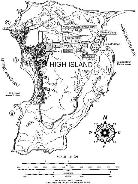
high island map

This Trail Map is from Exploring North Manitou, South Manitou, High and Garden Islands of the Lake Michigan Archipelago by Robert H. Ruchhoft (1991 Pucelle Press. Cincinnati, OH.)
The author's personal experience hiking on these Islands is interesting, the historical notes fascinating, and the distances, times, and pathfinding information useful.  

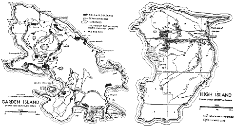
A comparison of High Island to Garden Island.

USGS maps comparing High to the slightly larger but lower Garden Island. While High offers a deep harbor and more varied terrain, Garden offers protection from storms in its three to four foot rocky harbor. [ Enlarged map of Garden Island ]


up

SitemapTop

Also on Beaver Island . Net

Home | The Book | News | Places | Excursions | People | History | Contact

Content & Images © 1999-2017 Beaver Island.Net.  All Rights Reserved.